I have just returned from just over a week’s brief explore of the red centre of Australia, and of course, I thought I had best share my experiences and tips, because you know you really want to go there!
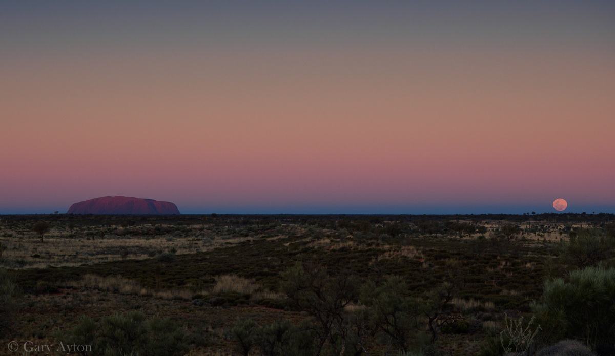
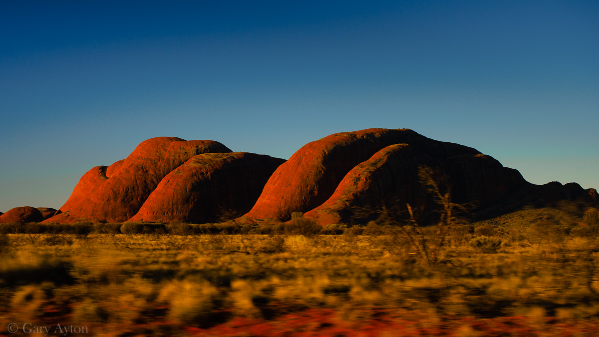
The last blue moon for 3 years and I managed to capture this one near Uluru, although from 30km west of Uluru, the moon was still too far south from Uluru to allow a telephoto lens to make it look larger and still capture it in the same image as Uluru. One is not allowed to just stop your car anywhere in the park so planning these shots are quite limited to certain locations. Olympus OM-D E-M5 hand held with Olympus mZD 12-40mm lens at f/5, 1/160th sec, ISO 200, 40mm focal length and Vivid picture tone.
Why go?
I must admit I was a Uluru sceptic who thought it was over-hyped and just a big rock, but walking around it is an awe inspiring feeling with a myriad of opportunities of different photographic imagery all varying with time of day and season.
Not only is it the largest monolith in the world and like an iceberg, we are only seeing the tip of it, it was formed millions of years ago by alluvium flowing from mountains to the south, and then gradually has eroded and in the past few thousand years has become a sacred site for the indigenous peoples who ascribe meaning to the many shapes created on its walls by erosion.
The region is just an awesome experience for anyone let alone the myriad of photographic landscape opportunities for the enthusiast photographer which include:
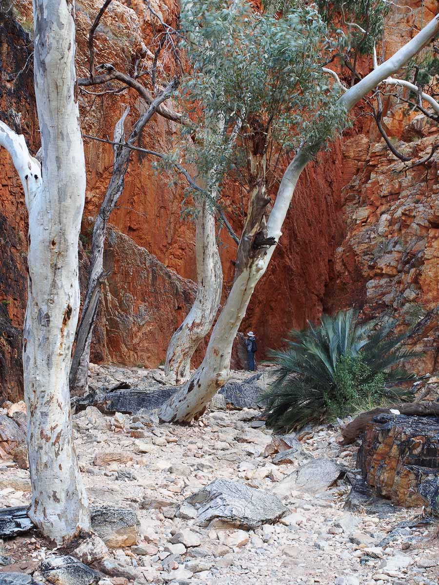
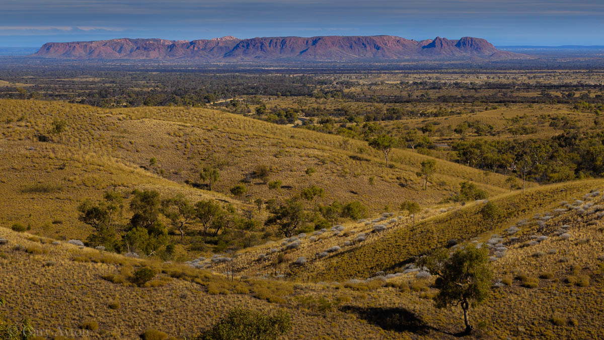
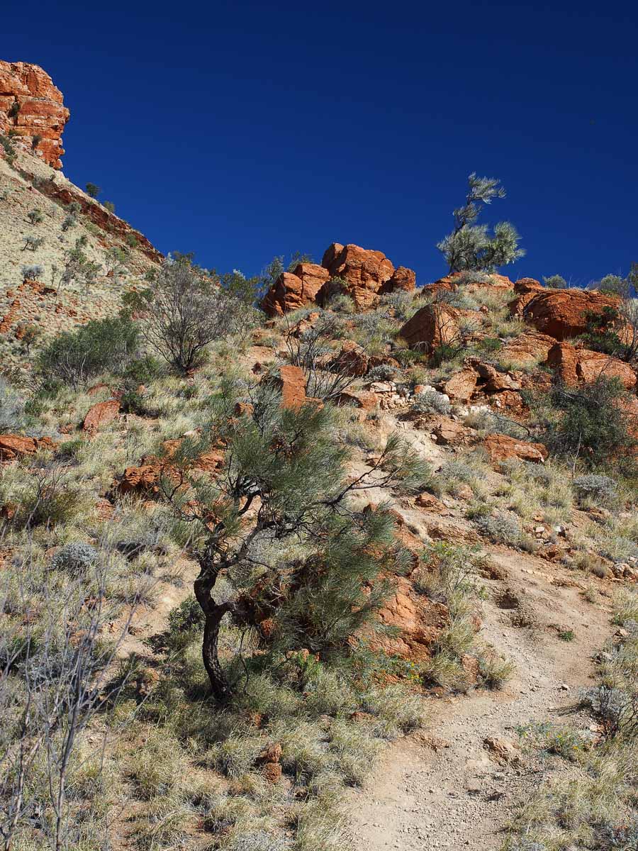
- West Macdonnell Ranges near Alice Springs and its many rugged gorges, bushwalks (including the famous 200km Larapinta Trail) and white ghost gum eucalypt trees
- East Macdonnell Ranges near Alice Springs and its rugged gorges and Artlunga ghost gold mining town
- learn about indigenous cultures at Alice Springs and view/purchase their art
- Alice Springs Telegraph Station
- Alice Springs Desert Park – allows you to see some wildlife that you are likely to miss out seeing on your trip
- Alice Springs Royal Flying Doctor service
- historic 19th century remote Hermannsburg German Lutheran missionary for indigenous peoples and nearby home of famous indigenous painter, Albert Namatjira
- Palm Valley – this requires a high clearance 4WD as it is very rough driving along the creek bed and will take over 3hrs return from Hermannsburg
- drive along the Mereneenie Loop Road to Kings Canyon from Hermannsburg and check out a very large comet impact site – Gosse’s Bluff
- Watarraka National Park (Kings Canyon) and bushwalks to the rim of the canyon as well as to the valley
- Rainbow Valley Conservation Reserve
- Henbury meteorite craters – asteroid impact sites via the unsealed Ernest Giles Rd which is another alternate route to Kings Canyon from Alice Springs
- dry salt lake beds at Stuart Wells (on private land – a million hectare cattle property)
- Chambers Pillar
- Uluru (Ayers Rock) – the largest monolith in the world and the spiritual centre of Australia – a must see for everyone – well worth the easy 11km 3.5hr walk around it as long as weather is mild
- Kata Tjuta (The Olgas) – even taller than Uluru, but very different being a many domed landscape of conglomerate rock making a striking scene at any time of day – has 2 main bush walks through the valleys
But first, let me introduce the region and try to convey its remoteness and climate – both of which are extremely important in your planning.
How do you get there?
It is in the centre of Australia in semi-arid to arid desert environs and over a 1,500 kilometres to the nearest state capital city – both Darwin and Adelaide are 1,500km from Alice Springs, while Melbourne is 2,260km, Perth 2,500km and Sydney 2,800km away.
To the novice, one may think that Uluru (formerly known as Ayers Rock) is just a day trip from Alice Springs – of course you would be wrong, it is over 460km but thankfully it is all bitumen now but Google estimates it should take you 6 hours by car (under 1hr by air), and that is not including another day or two diversion to the wonderful King’s Canyon.
One can thus drive from Darwin or Adelaide – preferably with a high clearance AWD or 4WD vehicle so you can better navigate the many side gravel roads to gorges, etc, or you can fly to either Alice Springs or direct to Ayers Rock airport – although direct flights to either airport from Melbourne only occur once a day – Sydney is more fortunate in this regard as there are more flight options.
Note that there are no commercial flights to Kings Canyon which is about 5hrs and over 470km from Alice by car or tour bus – the shorter distance “scenic” route on the 200km of corrugated unsealed dry weather only Mereneenie Loop Road requires a 4WD and also a permit fee and still takes over 5hrs and will test your car out!
Once in Alice or Uluru you can either use tour buses or hire a car (book early to avoid disappointment and avoid picking up the car at airports as these is more expensive) – note that there is an entry fee into Uluru-Kata Tjuta park – currently $25 per person which covers 3 days, and the park closes at 7.30pm in winter.
HOWEVER, be warned that in renting a car, even a 4WD, you will NOT be covered for any damage at night away from the township (risk of hitting wandering animals such as kangaroos, cows, or even camels, is too high for the insurance companies), and furthermore, most ban driving on unsealed roads (although you can usually drive to the tourist sites). A good option is renting from the only local company, Central Car Rentals which generally will pick you up from the airport in Alice for free and do permit more gravel road driving but still no night driving.
The ban on night rural driving means one needs to be creative in how they get to see sunrise or sunset away from their accommodation – consider camping as an option but this will not address sunsets at Kata Tjuta where you cannot camp overnight.
When should you go?
The peak season is the Australian winter as the days are not too hot for bushwalking (maximums range from 15 to 28deg depending on where the air flow is coming from the tropical north or the cold south) and the night sky shows off the wonderful southern Milky Way in all its glory (as long as the moon is not in the sky).
The climate is quite different from any of the Australian capital cities which are all coastal. The generally clear night skies mean nights can be cold, especially in winter when the overnight minimum can drop well below zero deg Celsius although usually is around 4degC (and up to 10deg on cloudy nights in winter) – but it will mean you MUST take some warm clothing if planning any night activities – gloves, beanie, scarf, warm jacket, boots and even thermals should be considered in winter.
The climate is much drier than humid Darwin, and this means very few mosquitoes, but bush flies can still be annoying when temperatures rise above 16-20degC and there is little wind.
Walking in winter generally just needs sturdy bush walk shoes, shorts or trousers, shirt, hat, sunglasses, sunscreen, water, lip balm, perhaps a fly mesh for face on hotter days, and warmer jacket and perhaps gloves for early morning walks.
Annual rainfall averages only 200mm or so (this is semi-arid so don’t expect expanses of endless sand dunes without vegetation – this can be found further east in the Simpson Desert) but can range from only 70mm to flood conditions every 12-15yrs or so at 900mm per year (most falling in the one month). The driest months are August and September while the wettest are Dec to Feb generally resulting from rains coming from the tropical storms to the north.
The many river beds are generally dry and only have running water after heavy rains – hence the famous Henley on the Todd canoe race in Alice springs in August each year is run on a dry river bed.
Although the days are much shorter in winter, the clearer skies in Winter means that average hours of sunshine is approximately the same each month.
From Oct-Mar, the average afternoon temperatures exceeds 30degC and thus any bushwalks should ideally be completed by 11am, especially in Dec-Feb when average 3pm temperatures are over 34degC. Many walks will be closed when temperatures exceed 36degC.
Winds are generally around 15kph in afternoons, but can be strong before storms and may occasionally create sand storms.
If you wish to photograph the Milky Way, make sure the moon will not be in the sky – ie. choose 3rd quarter to 1st quarter phases – if 1st quarter, you will need to wait for the moon to set around midnight.
If you wish to photograph the full moon rising near Uluru and photographed from Kata Tjuta sunset dune viewing platform, this will appear closest to Uluru at the equinoxes such as in March-April or Sept-Oct.
Where to stay?
There are a multitude of options in Alice Springs which is by far the most affordable location in central Australia – examples include:
- Lasseter’s Resort – nice clean rooms, most with two queen beds and en suite, new gym, day spa, and a lovely heated pool and outdoor spa which is fantastic in the winter sun, a number of eating options, but rooms may get booked out if conferences are on; free shuttle buses to town (stops at Aurora Hotel) every 2hrs from 10am-4pm
- Hilton’s Double Tree Hotel – perhaps the best restaurant in town and it’s a short walk from Lasseter’s – Hanuman’s Thai/Indian inspired menu
- Chifley Hotel – nice seafood restaurant – Barra on Todd
- in the shopping district – Aurora Hotel and many others including youth hostels, etc.
West Macdonnell Ranges:
- Glen Helen Resort – note this is out of phone reception but they have a great restaurant meal, tavern-like feel, camping options and affordable WiFi
- camping at various locations
Kings Canyon:
Yulara (the tourist township near Uluru and Kata Tjuta):
- all are generally quite expensive and much more so if you choose the luxury accommodation at Longitude 131 ($2,400 per night for a luxury tent with views of Uluru)
- Ayers Rock Resort offers a variety of accommodation including camping
What photography gear do you need to take?
Many of the walks are either long walks in the warm sun and/or strenuous uphill and downhill walks with often unstable, rocky paths and as you need to carry water and often extra clothing, one does not need to be further encumbered by heavy camera gear or tripods.
Furthermore airlines such as Jetstar tend to be more particular about both checked-in and carry on baggage weight and size – carry on baggage weight combined must not exceed 7kg.
Most photographs will probably be taken in the 24-80mm focal length range in 35mm full frame terms however, having a telephoto zoom allows one to get more options such as the smaller ghost gums growing off distant red cliffs, and abstract light/shadows on Uluru.
To reduce weight and size, my preference was the Olympus OM-D E-M5 and E-M1 Micro Four Thirds cameras with Olympus mZD 12-40mm f/2.8 lens and Olympus mZD 40-150mm f/2.8 lens (although I don’t have this lens and thus had to take the heavier and larger Olympus ZD 50-200mm f/2.8-3.5 SWD lens) – both with circular polarising filters to enhance the colour saturation and blue skies, and a spare battery and charger.
I mount both of these on a waist belt to take the weight off my neck and back – but despite my care and attention, the EVF of the E-M1 suffered damage from sunlight on the 4hr walk around Uluru – this is a well documented problem with the E-M1 and E-M10 (my E-M5 with an older style EVF did not suffer this damage and has not been documented as having this issue) – so be warned, one needs to take extra care to stop sunlight entering the EVF – or perhaps better still, buy 2 E-M5’s instead of the E-M1.
There are very few areas of flowing water and thus long exposure shots are generally not needed during the day so a ND400 10x filter is not likely to be needed unless there is rain forecast.
For those wanting sunset shots or Milky Way shots, a tripod will be needed, and perhaps ND gradient filters for sunset shots, and a tripod will be needed for shots where 36mp or more will be used.
Those with special needs may need extra lenses such as ultra-wide, fisheye or macro lenses.
Next posts will be details on each site
More information on my wiki.